A new Aquaculture Atlas for the Gulf of Alaska says the state’s aquaculture sector may be uniquely positioned to adapt to future climate scenarios, but that risks remain.
Shifts in water quality, disease outbreaks and intensified harmful algal bloom levels could threaten production and public health, the NOAA report said.
Additionally, expanding and shifting ranges of non-native or invasive species can affect ecosystem health and aquaculture viability in the future, according to the report.
The time series data used in the document, which was released in February, are relatively short, as they were not intended to distinguish climate-scale changes over time. Integrating longer-scale datasets, climate scenarios, and techno-economic modeling into future planning will be essential for building a resilient aquaculture industry, researchers said.
The situation calls for a balance of aquaculture development with ecological integrity and community values. Subsistence use, cultural resources and trust resource management require early engagement that can reduce conflict, provide for efficient permitting, and support conservation outcomes, researchers said.
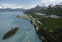
The Southcentral Alaska study area within this document includes coastal waters near Cordova, Seward and Valdez within the northern Gulf of Alaska, known for its glacial fjords, high marine productivity and strong fishing industry.

Every year brings seasonal migrations of Pacific salmon, halibut and sablefish into nearshore habitats. Resident populations of herring, sea cucumbers and shellfish support local commercial, sport and subsistence fisheries.
Aquaculture Opportunity Area option identification in Southcentral Alaska was shaped by a range of environmental and logistical constraints that limited the area available for suitability analysis within the areas. Steep bathymetry, complex oceanographic conditions driven by substantial glacial and freshwater inputs, and a high density of competing coastal uses resulted in the exclusion of large portions of Resurrection Bay in Seward, the Port of Valdez, and Nelson Bay in Cordova – collectively posing significant challenges to site selection across the entire Southcentral study areas, researchers said.
No intertidal Aquaculture Opportunity Area options were identified in the region, primarily because of steep bathymetric profiles and rocky shorelines that restrict the availability of suitable habitat at a scale consistent with the planning goals. Such physical limitations have historically precluded geoduck clam aquaculture in the region.
Still, oyster farms in Cordova area do utilize intertidal “hardening sites.” The minimal acreage needed for hardening sites falls outside planning goals for the Aquaculture Opportunity Area process but researchers acknowledge their critical importance to the oyster industry.
NOAA has spatial planning tools designed to support Alaska’s coastal communities as they navigate the complexities of marine development, tools that can help identify sites that balance opportunity with stewardship.
In Alaska, this means accounting for subsistence practices, fisheries resilience for working waterfronts, and the natural resources key to Alaska’s cultural identity and economic success. The analysis described in this report supports Aquaculture Opportunity Area identification by offering spatial modeling results tailored to Alaska’s unique geography and governance.
Authors of the study recommend that use of the atlas should remain focused on Aquaculture Opportunity Area planning rather than early siting considerations, as broader applications will require caution and context-specific evaluation. The analysis also revealed several gaps that limit comprehensive planning, including commercial and subsistence fisheries data that were often coarse or confidential, making it challenging to assess spatial overlaps.
NOAA is continuing to develop science-based tools to help coastal communities navigate through and balance development challenges, the report said. This process uses the best available data to account for key environmental, economic, social and cultural considerations to find appropriate space for sustainable aquaculture and support efficient permitting.
The report’s analysis supports Aquaculture Opportunity Area identification directly through the provision of regional spatial modeling results to inform possible locations for these areas in the Gulf of Alaska.
Funding for the document was provided by NOAA, including the National Centers for Coastal Ocean Science and the National Marine Fisheries Service’s office of Aquaculture. Also contributing to the document were the Gulf of Alaska Aquaculture Opportunity Area Siting Team: The Alaska Department of Fish and Game, Alaska Department of Natural Resources, Alaska Department of Environmental Conservation, and Alaska District of the U.S. Army Corps of Engineers.